Despite the unparalleled accuracy and determinism that terrestrial laser-based point clouds provide when capturing the as-built data of a building, three key challenges largely remain – point cloud data tends to be huge; it can be hard to interpret exactly what is happening in the dark spaces or over-exposed areas; and with all of these 3D dots in space, it’s not always easy picking the right points while conversely it’s all too easy to focus on something beyond what you’re meant to be looking at.
These three challenges are the very reason that Cintoo was established, and why we created our high-resolution 3D mesh-based point cloud data to solve each of these problems.
Size
Laser scanning has become widely adopted as the method to capture as-built data because it provides accurate point clouds and is far more reliable than photogrammetry, particularly for indoor capture. However, a common problem with this point cloud data is that it is huge and therefore tends to be desktop centric. Sharing the data has traditionally been done via a hard disk and, until now, uploading such big data to the cloud for visualization, sharing or distribution has been a real challenge.
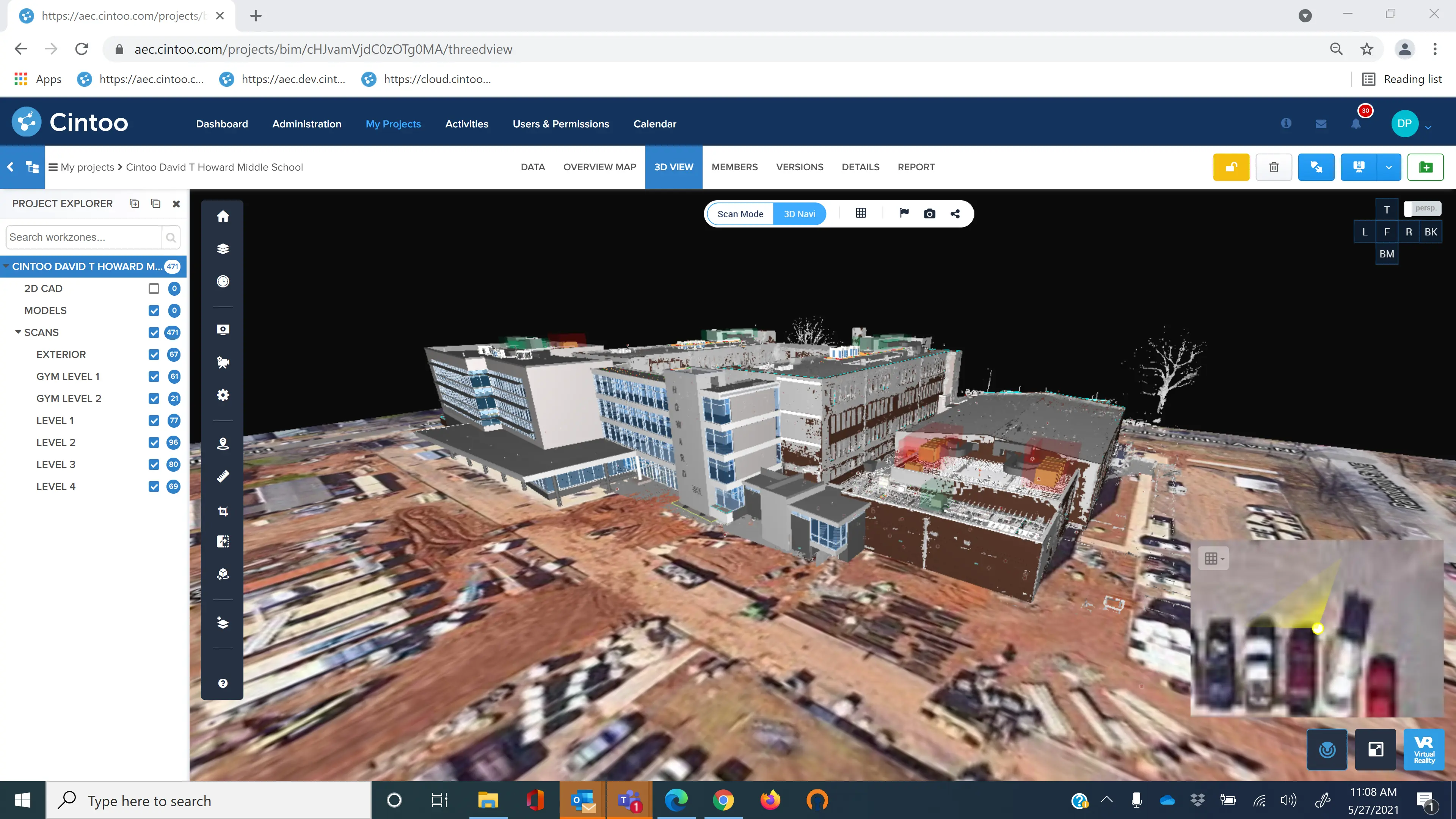
Cintoo Cloud has changed all this by turning point clouds into 3D surface meshes, compressing the data to make it 10 to 20 times smaller than its original size while still maintaining its accuracy and project structure. Smaller and therefore more manageable, the data can be uploaded to Cintoo’s secure cloud where it can be viewed and shared. Furthermore, this compressed data can easily be converted back into point clouds (E57, RCS or RCP) or unified meshes (OBJ, FBX or STL) when needed for its distribution back in the desktop world.
Interpretation
When it comes to interpreting the data, cameras are no match to the laser beam. Take a boiler room, for example, which tends to be dark. There is a limit to what the camera can capture with its RGB sensor and therefore what can be clearly identified as images are often under or over exposed. A laser beam, on the other hand, will always capture the actual geometry of the space, revealing things that a camera would likely have missed.
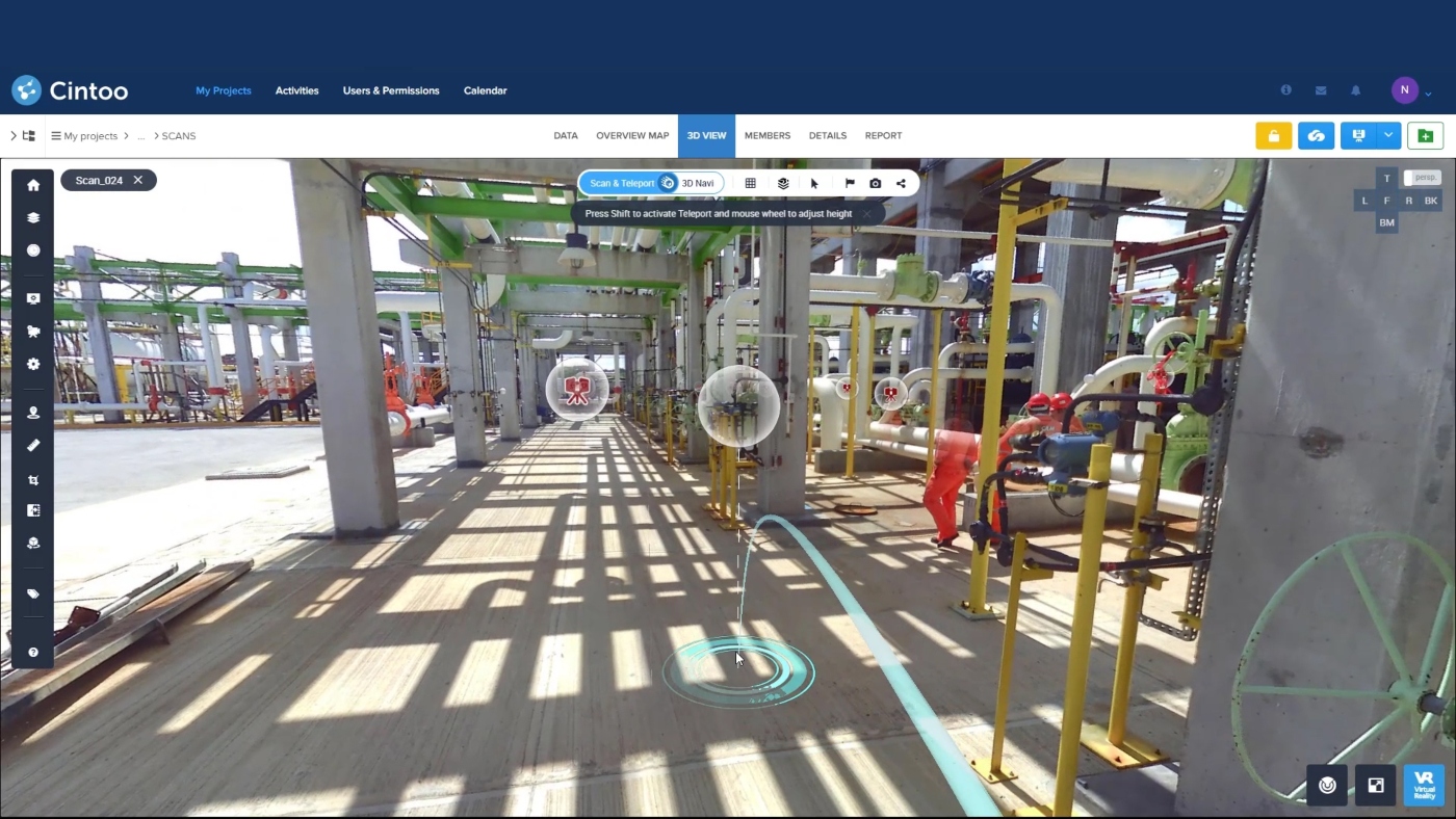
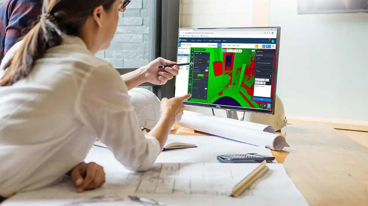
Cintoo Cloud provides the clarity needed to accurately assess your as-built data. By streaming the high-resolution mesh in Cintoo Cloud’s web viewer, you can see details in your laser scan data that you wouldn’t normally be able to see in a standard point cloud viewer, being able to recognize damage to a surface or pipes in a dark recess.
See-through ambiguity
Point clouds by their very nature are ambiguous, allowing you to see through the dots, whether that’s walls, windows or ceilings. When you’re working with point clouds you could be picking a point which is actually several meters behind where you think you’re looking. Cintoo’s high-resolution surface mesh solves this problem by removing any ambiguity so you can view every surface with the finest detail.
If you’d like to turn point cloud problems into a thing of the past, you can trial Cintoo Cloud for 30 days absolutely free here: www.cintoo.com. Or contact us via email sales@cintoo.com to talk to us about how Cintoo Cloud could help solve your unique challenges.