Unlock the Potential of 3D Laser Scanning
Discover what 3D laser scanning is and how you can maximize it in all your project workflows.
What is 3D Laser Scanning?
3D laser scanning is a technology used to capture precise, high-resolution, three-dimensional data of physical objects or environments. It works by emitting laser beams that bounce off surfaces and return to the scanner, recording detailed measurements at various points. By collecting millions of these data points, called “point clouds,” a 3D laser scanner can create an exact digital replica of the scanned object or space.
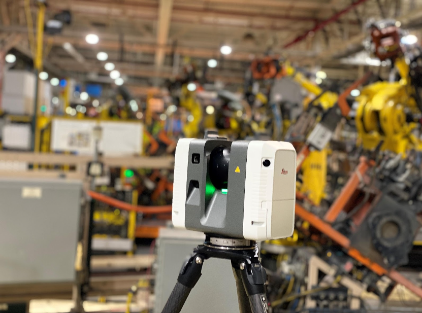
Laser scans can come from a variety of hardware options, including terrestrial, mobile or drone scanners that survey an area and generate point clouds.

This technology is widely used in fields like architecture, engineering, manufacturing, and heritage preservation. For example, it helps architects accurately map existing structures, aids engineers in reverse engineering complex parts and assists archaeologists in preserving historical sites digitally. Scans can be used to produce CAD models, assess structural integrity, document as-built conditions, or even create virtual walkthroughs.
3D laser scanning is valuable because it captures details with an impressive degree of accuracy and speed, often far more precisely than manual measurements. The data it collects can be processed and used for visualization, simulation, or replication, providing a powerful tool for modern industries that require exact digital representations of the real world.
3D laser scanning offers a way for professionals to visualize their projects with real data, but there are so many other use cases for 3D scan data that can transform project management by making all workflows fast and more efficient with no compromise to accuracy.
Challenges Professionals Face in Utilizing 3D Scan Data
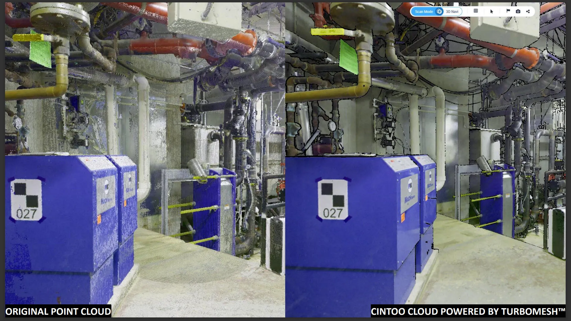
Utilizing 3D laser scanning presents a range of challenges, primarily due to the complexity and volume of data produced by high-resolution 3D laser scanners. One of the most immediate issues is handling the massive data sets generated; a single scan can produce millions to billions of data points, creating “point clouds” that can be extremely large in file size. This poses storage, processing, and hardware challenges, as high-performance systems are often required to manage, analyze, and visualize the data effectively.
Raw point clouds also come with limitations that complicate their direct use in applications like CAD modelling or 3D visualization. Point clouds are essentially collections of unstructured data points without inherent surface information, which means they need to be processed into structured models like meshes or surfaces to be practical for most applications. This conversion requires specialized software and can be computationally intensive, often necessitating significant time and expertise.
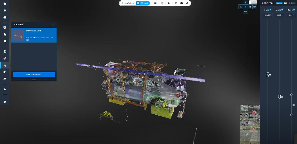
Another challenge is navigation within these scans. Point clouds, even when visualized, can appear as a dense cluster of points without clear boundaries, making it difficult to interpret complex or detailed features, especially in large-scale environments like construction sites or industrial plants. Users may face difficulties in isolating specific areas of interest or identifying particular features within a dense scan.
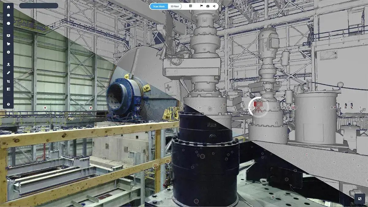
Overall, while 3D laser scanning provides valuable, highly accurate data, these challenges in data size, processing requirements, and usability limit its accessibility and efficiency for many applications.
However, there’s a solution out there that completely eliminates these challenges altogether.
The Cintoo Solution
Cintoo eliminates these challenges with its full suite of product offerings. The SaaS-based platform is hardware agnostic, meaning it can intake any laser scan data from any application available. Once point clouds are processed, Cintoo’s innovative TurboMesh technology instantly transforms 3D scan data to 3D meshes.
3D meshes are needed to seamlessly move through point cloud data in an online environment. Point-cloud-to-mesh technology allows users to navigate their project sites online in easy, intuitive ways— no expertise required! Navigation is further enhanced by platform offerings like Teleportation which allows Cintoo users to move to any setting in their project site, regardless of scan setup location.
Furthermore, Cintoo enhances 3D data visualization with no limits to data processing, making it easier to interact with laser scan data. As one Joey Ciotti, Reality Capture Specialist at Precision Point Inc. said, “Cintoo gives us a streamlined, user-friendly way for our clients to view a quality and organized BIM model and point cloud seamlessly.” Cintoo allows for all 3D scan data to be rendered and used within a virtual, online setting.

The virtual, online setting means that anyone can access their team’s Cintoo projects, regardless of where they’re located! Sharing, collaborating on, and distributing the data has never been easier. Remote site inspections and further maintenance of project facilities can occur seamlessly and with greater collaboration.
All of these platform capabilities lead to smarter and improved use of 3D scan data for huge project sites, transforming the way that projects are managed and maintained.
The Practical Value of 3D Scan Data
For construction architects and engineers, documenting as-built conditions helps teams assess structural integrity, plan renovations, and model new additions with a clear understanding of existing conditions. Navigating these models allows for efficient comparisons between design plans and current conditions, reducing errors. With Cintoo, users can overlay an unlimited number of BIM/CAD models to assess how as-built conditions line up to as-modeled, potentially detecting clashes before they occur.
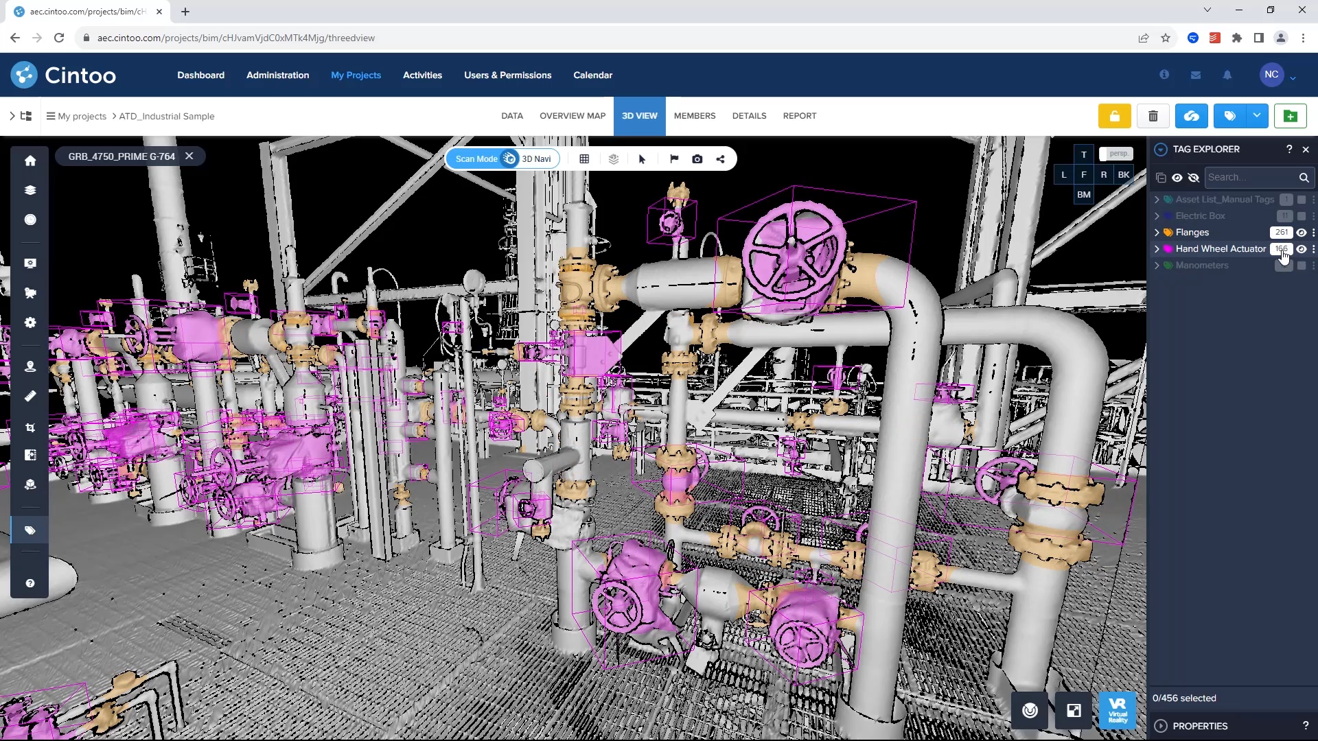
For manufacturing processes, quality control and assurance play a huge role in maintaining huge facilities and plants. When inspecting complex or large parts, manufacturers convert scans to 3D models to overlay against design specifications. This enables precise comparisons, identifying areas where actual production deviates from the ideal design. Navigating these models in Cintoo is far more efficient than manual inspection. Maintenance also requires routine inspection and validation of asset-intensive environments. With Cintoo, report and progress monitoring, coupled with certain tools like annotating, measuring, and asset-tagging, can help professionals make sense of massive facilities, identifying what’s what in a 3D environment.
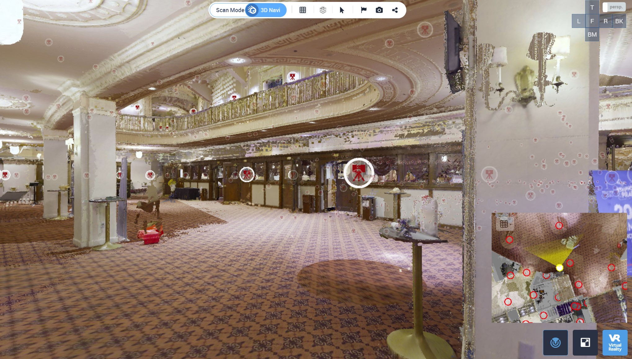
Lastly, the use of 3D scan data can extend to different and new use cases altogether, like preserving historical sites. Historical preservation seeks to maintain the cultural heritage and existing structures of key sites, as exemplified in this conversion of a historic theatre into viewable point cloud data processed by the Cintoo platform. All scan data came from Precision Point Inc., who were then able to convert point cloud data into 3D meshes using Cintoo.
Want to learn how your 3D scan data empowers all data workflows, identifying details that help in project development? Read The Details in the Data for more information!
