A scan team hands over 400 GB of point cloud data for a hospital renovation. By the next morning, the architect wants to look at the ceiling voids and the MEP contractor is asking about pipe clearances. Neither of them has point cloud software installed.
That’s usually when the point cloud vs mesh question comes up. In this guide, we’ll look at which format suits which job, and where the real trade-offs on file size and accuracy are. We’ll also cover how each one gets you into Revit or your CAD tool.
Want to see both formats side by side on a real project? Book a free demo!
The short answer
Traditionally, teams had to choose between point clouds for survey-grade accuracy and meshes that non-specialists can open. With Cintoo, you don't have to choose. Your scans become a mesh that keeps the accuracy of your scanner, so anyone can view, measure and annotate in a browser, and modelers can export a point cloud for Revit when they need one. One source of truth for everyone.
What is the difference between a point cloud and a 3D mesh?
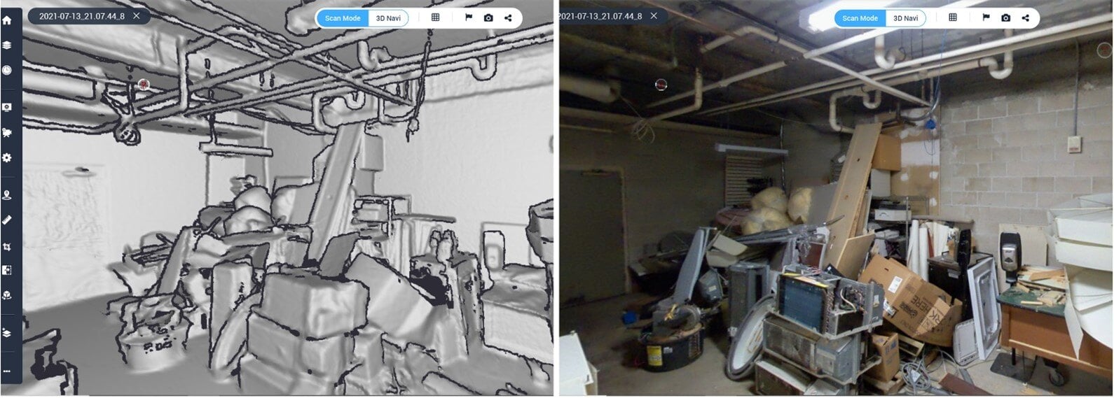
A point cloud is pretty much what the name says: millions, sometimes billions, of individual points, each with an X, Y and Z position recorded by the laser scanner. Most also carry color and intensity. A 3D mesh takes those same measurements and joins them up into surfaces made of small triangles.
On screen, you notice the difference fast. Zoom into a point cloud and the gaps between points start to show. You can see straight through a wall into the room behind it, and it’s surprisingly easy to click a point several meters behind the surface you meant to measure. With a mesh, the surface is solid. A pipe tucked into a dark corner looks like a pipe, and you can actually spot a crack in the concrete.
One caveat: not all meshes are built for engineering. Photo-textured meshes are often designed for smooth walkthroughs, and they trade away scanner resolution and accuracy to get there. That’s fine for a client presentation, but not for checking a clearance. For engineering work, you need a mesh that keeps the scanner’s accuracy and the full project structure, including scan positions and panoramic images. That’s how Cintoo works: the mesh is a 1:1 replica of your scan data, so you can measure and annotate it with the same confidence as the original point cloud.
Point cloud or mesh? A decision table by use case
The right format depends less on the data and more on who needs it and what they'll do with it. Use this table as a starting point.
|
Use case
|
Main users |
Best formats |
Why |
|
Survey-grade registration and control
|
Surveyors, scan technicians
|
Point cloud
|
You need every raw point, registration reports and full traceability to the source.
|
|
Scan-to-BIM modeling
|
BIM modelers, VDC teams
|
Point cloud (cropped), mesh for reference
|
Revit and Navisworks model against point clouds; a mesh helps modelers read the scene first.
|
|
Sharing as-built conditions
|
Project managers, architects, clients, contractors
|
Mesh
|
Lightweight, opens in a browser, no specialist software or training needed.
|
|
BIM verification (scan vs BIM)
|
BIM managers, QA/QC
|
Mesh with deviation analysis
|
Continuous surfaces make deviations easy to spot and explain to non-experts.
|
|
Digital twin for operations
|
Site managers, owners
|
Mesh (scan vs scan, scan vs BIM)
|
Fast comparison between capture dates without moving huge files.
|
|
Day-to-day asset access.
|
Plant, facility and asset managers
|
Mesh plus 360° imagery
|
Many users need daily access; imageryClarity and speed for daily users, without giving up accuracy.
|
|
Day-to-day asset access.
|
Owners, surveyors
|
Source data in Cintoo, point cloud export when required
|
One source of truth, exportable to point cloud for any downstream need.
|
Rule of thumb: start with the mesh. Export a point cloud only when a specific tool, like 3rth party software, requires one.
File size, performance and accuracy compared
File size is usually where sharing breaks down. A raw point cloud is too big to move around easily, so it ends up sitting on one workstation in one office. Then a contractor asks about a clearance, and someone has to export a crop and send a download link, or just drive out to site. Decimate the data 10 to 20 times and that problem mostly goes away. It can sit in the cloud, and anyone with access can open it.
Performance comes down to the same thing. A mesh that streams at multiple resolutions only loads detail for the area you’re looking at. You can start moving around the model straight away, without waiting for the whole dataset to load first.
Accuracy is the one to push vendors on. A mesh is only safe to base engineering decisions on if the conversion keeps the accuracy of the original scanner. So ask how the mesh is made. Does it keep the scan positions and project structure? And if you need the original points back, can you get them?
|
Criterion
|
Point cloud |
High-resolution 3D mesh
|
|
File size
|
Very large: a single project often runs to hundreds of GB
|
Typically 10 to 20 times smaller than the source point cloud
|
|
Where it opens
|
Mostly desktop software on powerful workstations
|
Any desktop or laptop web browser, via streaming
|
|
Visual clarity
|
Gaps between points; easy to misread depth
|
Continuous surfaces; details like cracks or pipe edges are clear
|
|
Accuracy
|
Full sensor accuracy: the raw scanner measurement
|
Same sensor accuracy, as a 1:1 replica of the scan (unlike photo-textured meshes, which often trade accuracy for smooth walkthroughs)
|
|
Upload and transfer
|
Slow; often shipped on hard drives
|
Much faster to upload, store and share
|
|
Skills needed
|
Trained users
|
Anyone who can use a browser
|
When you should keep the raw point cloud
For day-to-day collaboration, the mesh wins. That doesn’t mean you can throw the point cloud away. Hang on to the raw data if:
- You’re delivering a survey. Many contracts ask for the registered point cloud and its registration report as part of the deliverable.
- Your modelers work in Revit or Navisworks. Those tools model against points, so the modeling team still needs them. Ideally just the area they’re working on, not the whole site.
- You might need to prove what was there. If a dispute or an insurance claim comes up, the raw capture is your evidence.
- You may want to reprocess it. Better registration or classification software will come along, and it’ll need the original data to work from.
So in most cases you keep both. The point cloud is your source of record, and the mesh is what people actually open. What matters is being able to switch from one to the other without losing accuracy.
Export paths to CAD and BIM
You don’t have to share and model from the same file. On most projects, the workflow looks something like this:
- Capture and register your scans the way you normally do.
- Upload them to Cintoo, where they’re converted into a mesh that keeps your scanner’s accuracy. Scan positions and project structure come along with it.
- Review the data in the browser. Check it against the BIM model or an earlier scan, with 360° photos alongside if you have them.
- Crop what the modelers need and export it as a point cloud in the format their software reads.
- Model or run clash detection in Revit, Navisworks or whatever CAD tool your team uses.
- Bring the model back into the platform and check it against the scan.
Step 4 is the big time saver. Subcontractors don’t need the whole dataset, just the part of the site they’re working on, in a format their software can read. With Cintoo, you can also turn the mesh back into the original point cloud format without losing accuracy, and you can convert back to the original point cloud source, preserving a 1:1 replica of the original dataset (Export Scan Data : E57, POD, RCS, RCP).
5 common mistakes to avoid
- Sending the full point cloud to everyone. Most people on the project just want to see what’s there. They don’t want to process raw scan data. Big file transfers also slow things down, and before long nobody’s sure which version is the latest.
- Trusting a measurement you took through a wall. In a point cloud, it’s easy to snap to a point behind the object you were aiming for. If a number looks off, check it on the mesh or in a 360° photo.
- Assuming any mesh is good enough for engineering. A photo-textured walkthrough can look great and still be the wrong thing to check a clearance on. Find out how the mesh was made before you rely on it.
- Deleting the raw data once it’s converted. Sooner or later someone will ask for it, for a deliverable or an audit. Archive it, even if nobody opens it day to day.
- Keeping scans and models in separate places. If the scan is on one drive and the BIM model on another, nobody spots the deviations until they show up on site, and by then they’re expensive. Put the two side by side.
How Cintoo handles both formats
This is the problem Cintoo was set up to fix. Its patented TurboMesh technology turns each scan position into a 3D mesh that’s 10 to 20 times smaller than the original point cloud. The scanner’s accuracy and the project structure stay intact.
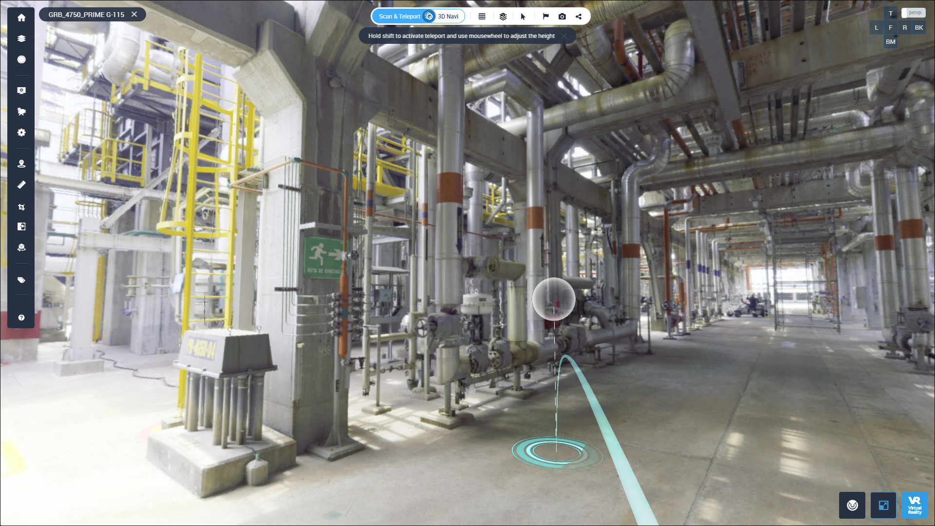
Because it runs in a desktop or laptop browser, the contractor checking a clearance and the owner walking through the building can look at the same as-built data without installing anything. Which edition you use depends on the job. The BIM Edition is for checking scans against models or earlier scans, and the Twin Edition is for managing operational assets. The 360 Edition brings 360° imagery into the picture.
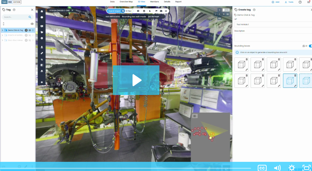
Modelers still get their points. They crop the area they’re working on and download it as a point cloud or mesh for Revit, Navisworks or another desktop tool. The raw data stays as your record, and everyone else works from a version they can actually open.
FAQ: Point Cloud vs 3D Mesh
Is a 3D mesh less accurate than a point cloud?
It depends on how the mesh was made. A mesh built for engineering work can keep the full accuracy of the scanner. Photo-textured meshes, the kind made for walkthroughs, often lose some accuracy so they run smoothly.
Can I convert a mesh back into a point cloud?
Some platforms let you. In Cintoo, you can turn the mesh back into the source point cloud format, structured or unstructured, and open it in Revit or Navisworks.
Why are point cloud files so large?
Every scan position captures millions of points, and each point stores its position plus, usually, color and intensity. A large site can have hundreds of scan positions, so the files grow fast.
Can I view a point cloud in a web browser?
Yes, some viewers stream point clouds online. Big datasets still load slowly, though, and they’re hard to read if you don’t work with scans every day. For people outside the scanning team, a browser-based mesh viewer is usually easier.
Which format should I use for a digital twin?
For operations and maintenance teams who use the twin every day, a high-resolution mesh with 360° imagery usually works best. Keep the original point cloud archived in case you need it later.



.png?width=48&height=48&name=sensors%20(1).png)
.png?width=65&height=50&name=sensors%20(2).png)


.png?width=69&height=50&name=cloud_done%20(1).png)


.png?width=42&height=49&name=Group%2015496%20(2).png)


.png?width=60&height=60&name=calendar%20(1).png)


.png?width=48&height=45&name=image%20175%20(1).png)