Key Takeaways: As-Built BIM Documentation
- As-built BIM documentation captures real-world site conditions using 3D laser scanning, giving teams accurate data for design validation and QA/QC.
- Cloud-based platforms like Cintoo convert dense point clouds into lightweight 3D meshes, making scan data accessible to unlimited stakeholders.
- Comparing as-built scans against design models helps detect clashes and deviations early, reducing costly rework and schedule delays.
- Effective scan-to-BIM workflows require clear data standards, defined LOD targets, and tools that allow browser-based collaboration.
- Enterprise teams benefit from hardware-agnostic platforms that integrate with existing BIM, GIS, and enterprise systems.
What Is As-Built BIM Documentation?
As-built BIM documentation is the process of capturing and representing actual site conditions in a digital format that aligns with Building Information Modeling (BIM) standards. Unlike design BIM models that represent planned construction, as-built documentation reflects what was actually constructed.
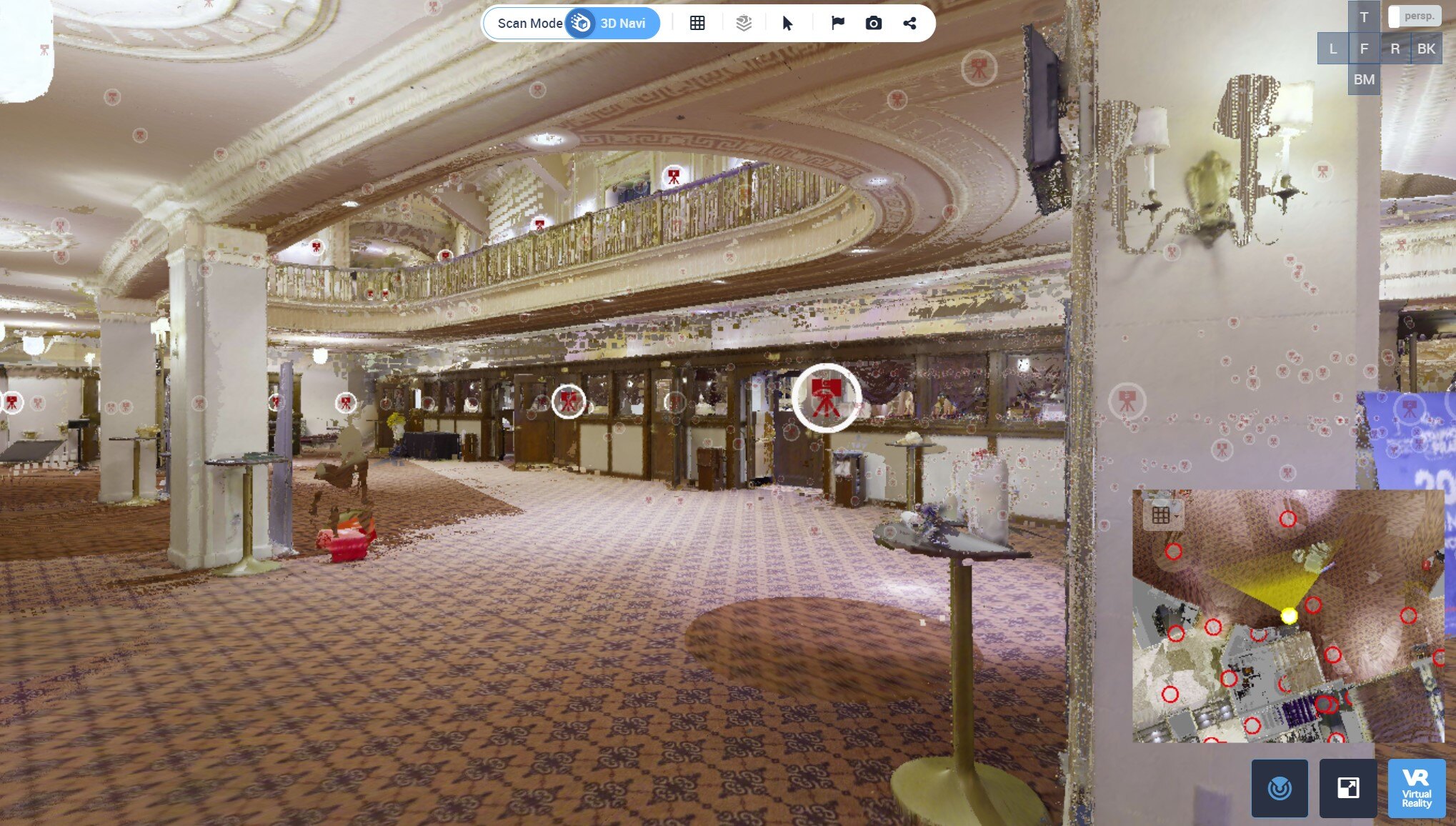
The process typically begins with 3D laser scanning or other reality capture methods. These technologies create dense point clouds containing millions of spatial data points. The point cloud data then gets processed, aligned, and compared against the original design model.
For enterprise AEC and industrial teams, as-built documentation serves as verified, repeatable data for ongoing operations, maintenance planning, and future renovation projects. It becomes a living reference rather than a single snapshot in time.
Why Does As-Built BIM Documentation Matter for Enterprise Teams?
Completed construction projects rarely match their original design documents exactly. Field conditions, unforeseen obstacles, and real-time decisions lead to deviations. Without accurate as-built documentation, these changes go unrecorded, creating problems for facility management, compliance, and future modifications.
Enterprise teams face particular challenges, with large-scale projects involving multiple trades, distributed teams, and complex coordination requirements. A single missed deviation can cascade into expensive rework, safety issues, or operational disruptions.
With as-built BIM documentation, teams can verify construction progress, validate installations, and document final conditions with survey-grade precision.
How Does 3D Laser Scanning Support As-Built Documentation?
3D laser scanning captures millions of measurement points in seconds. Modern terrestrial laser scanners deliver millimeter-level accuracy across distances up to hundreds of meters. This speed and precision makes scanning practical for large-scale construction sites and complex industrial facilities.
The scanning process generates point clouds that represent physical surfaces in three-dimensional space. Each point contains X, Y, and Z coordinates along with intensity values. Some scanners also capture color information, creating photorealistic representations of scanned environments.
Types of Scanning Technology for As-Built Capture
Static terrestrial scanners offer the highest accuracy for stationary capture positions. These devices rotate 360 degrees, capturing everything visible from a single location. Multiple scan positions get registered together to cover entire facilities.
Mobile mapping systems mount scanners on vehicles or handheld devices. They capture data while moving through spaces, trading some accuracy for speed and coverage. Mobile systems work well for linear assets like corridors, tunnels, and roadways.
Drone-mounted LiDAR extends scanning capabilities to rooftops, facades, and areas difficult to access from ground level. Combining aerial and terrestrial data creates complete coverage of building exteriors and surrounding sites.
 What Are the Steps in a Scan-to-BIM Workflow?
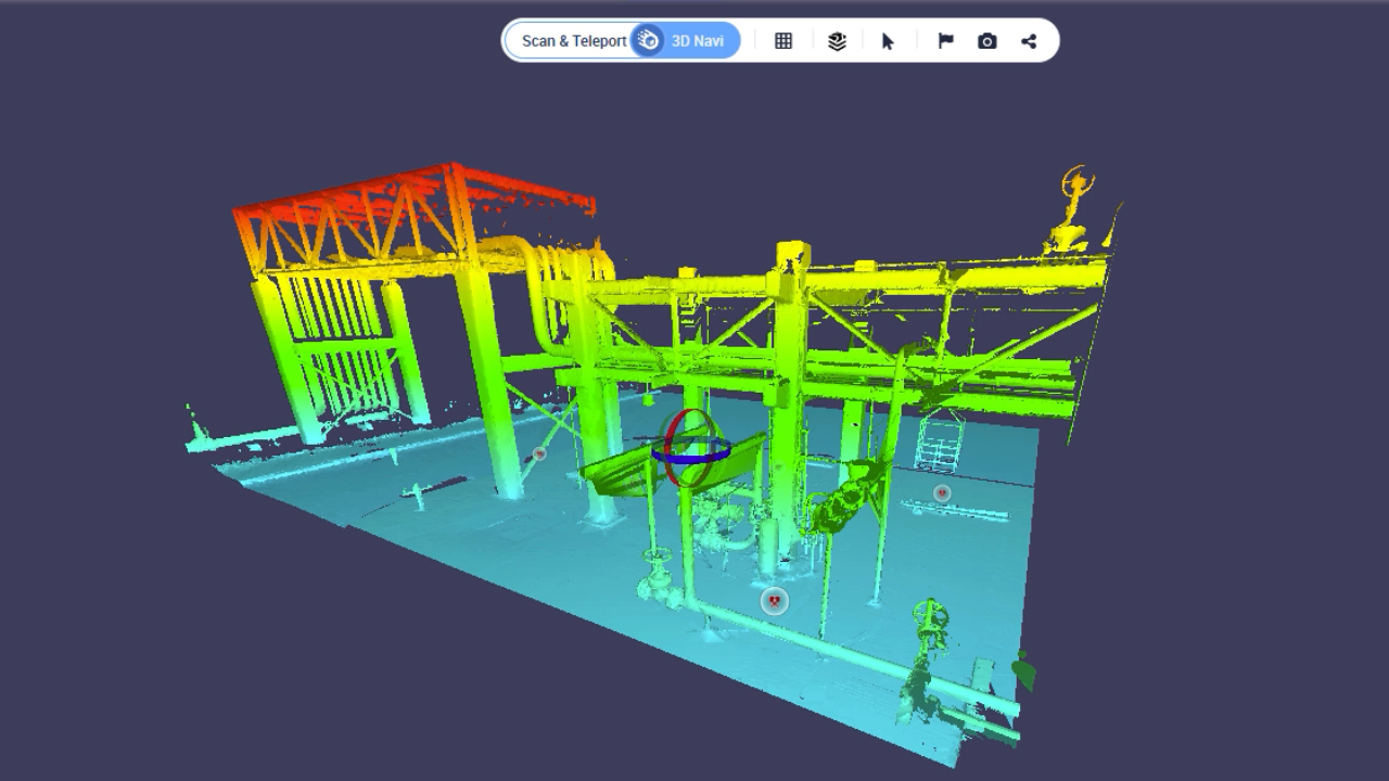
Moving from raw scan data to usable BIM documentation requires a structured workflow. Each step builds on the previous one, and skipping steps leads to quality issues downstream.
Step 1: Project Planning and Scope Definition
Define the purpose of your as-built documentation before scanning begins. QA/QC applications require different accuracy levels than general documentation. Facility management needs focus on specific asset types. Renovation projects prioritize spatial relationships and structural elements.
Establish Level of Development (LOD) requirements early. LOD 200 captures general geometry and approximate dimensions. LOD 300 includes accurate dimensions and specific system representations. LOD 400 adds fabrication-level detail. Higher LOD targets require more scanning positions and longer processing times.
Step 2: Field Scanning and Data Capture
Position scanners to achieve complete coverage with appropriate overlap between adjacent scans. Target placement helps with registration, though modern software increasingly supports targetless workflows. Document scan positions and capture metadata for quality control.
Scan density affects both file sizes and downstream usability. Dense scans capture fine details but create larger datasets. Balance resolution against project requirements and processing capabilities.
Step 3: Point Cloud Registration and Processing
Registration aligns multiple scans into a unified coordinate system. Cloud-to-cloud registration matches overlapping areas between scans. Target-based registration uses surveyed control points for higher accuracy. Most projects combine both approaches.
After registration, clean the point cloud by removing noise, outliers, and unwanted objects. Construction sites often contain temporary equipment, individuals, and materials that should not appear in final documentation.
Step 4: Cloud-Based Collaboration and Sharing
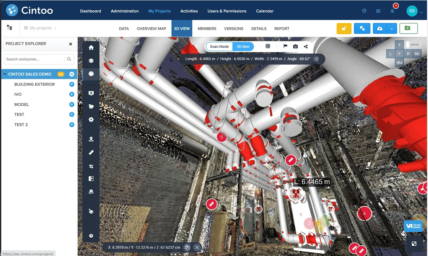
Large point cloud datasets create collaboration challenges. Raw scan data often exceeds multiple gigabytes, making file sharing impractical. Cintoo addresses this by converting point clouds into high-fidelity 3D meshes that stream directly in web browsers. Teams access full-resolution data without downloading massive files or requiring specialized hardware.
Cloud platforms enable unlimited stakeholders to view, measure, and annotate scan data. Project managers, engineers, contractors, and owners all work from the same dataset, eliminating version confusion and information silos.
Step 5: BIM Model Comparison
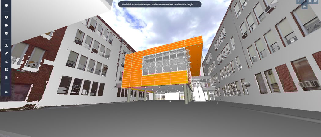
Comparing existing design models with as-built scans helps identify issues early in the process. Visual diff tools, for example, highlight deviations between planned and actual conditions. Color-coded displays make discrepancies immediately visible, even to non-technical stakeholders.
 How Does As-Built Documentation Improve QA/QC Processes?
Quality assurance and quality control represent one of the highest-value applications for as-built documentation. Scan-based QA/QC captures everything visible from scanner positions. Teams can verify every accessible surface, connection, and installation rather than sampling representative elements. This thorough approach catches problems that sampling-based methods miss.
Detecting Deviations Before They Cause Problems
Comparing as-built scans against design models reveals deviations automatically. Software calculates distances between scan points and model surfaces, flagging areas that exceed tolerance thresholds. Teams review flagged areas rather than manually searching for problems. Early deviation detection prevents cascading issues and spiraling costs.
Documenting Progress and Completion
Regular scanning creates a timeline of construction progress. Comparing scans from different dates shows what work occurred between captures. Project managers track actual progress against schedules without relying solely on contractor reports.
Completion verification uses final scans to confirm that all specified work exists and meets requirements. This documentation protects owners during warranty periods and supports handover to facility management teams.
What Role Does As-Built Documentation Play in Cost Control?
Construction rework consumes significant portions of project budgets. Industry estimates suggest rework accounts for 5% to 20% of total project costs. Much of this rework stems from design conflicts, coordination failures, and construction errors that accurate as-built documentation could have prevented.
Reducing Rework Through Early Detection
Scan-based verification catches installation errors before subsequent trades begin their work. Discovering a misaligned duct run before drywall installation costs far less than opening finished walls to correct the problem. The same principle applies across all trades and building systems.
Turner Construction reported 98% accuracy in design implementation using Cintoo integrated with issue tracking platforms. Their workflow identified problems in scan data, pushed issues directly to trade partners, and tracked resolution through completion.
Minimizing Change Orders
Accurate as-built conditions reduce change orders during renovation and retrofit projects. Design teams working from verified site data encounter fewer surprises during construction. Field modifications decrease when designs account for actual conditions rather than assumed ones.
For industrial facilities, as-built documentation supports maintenance planning and equipment replacement. Facility managers know exact clearances, routing paths, and spatial constraints before beginning work. This knowledge reduces discovery-based changes that drive cost overruns.
 How Can Enterprise Teams Scale As-Built Documentation?
Individual project documentation delivers value. Enterprise-wide programs multiply that value through standardization, integration, and accumulated data assets. Scaling requires addressing technology, process, and organizational factors.
Establishing Data Standards
Consistent standards enable data reuse across projects and over time. Define file formats, coordinate systems, accuracy requirements, and metadata schemas. Document these standards and train teams on compliance.
Integrating with Enterprise Systems
Scan data gains value when connected to other information sources. Linking as-built geometry to asset management databases, maintenance records, and IoT sensors creates actionable digital twins. Cintoo's open APIs and integrations support connections with BIM platforms, GIS systems, and enterprise applications.
Building Internal Capabilities
Successful programs require trained personnel at multiple levels. Scanning technicians capture quality data in the field. Processing specialists register, clean, and prepare datasets. Modelers extract BIM elements from point clouds. Analysts interpret comparison results and recommend actions.
Some organizations build these capabilities internally. Others partner with service providers for specialized tasks. Most successful programs combine internal expertise with external support based on project volumes and complexity.
What Technology Considerations Matter for As-Built Documentation?
Technology choices affect both immediate project success and long-term program viability. Evaluate options against current needs while considering future requirements and industry direction.
Hardware Flexibility and Vendor Independence
Scanning hardware continues evolving rapidly. Scanner manufacturers improve accuracy, speed, and usability with each generation. Locking into single-vendor ecosystems limits future flexibility and potentially increases long-term costs.
Hardware-agnostic platforms accept data from any scanner or capture device. This flexibility allows teams to select optimal equipment for each project type. It also protects investments if preferred vendors change direction or pricing.
Cloud Architecture and Scalability
Local software installations struggle with large datasets and distributed teams. Cloud platforms scale automatically, handling everything from single-site projects to global facility portfolios. Browser-based access means teams work from any location without installing specialized software.
Security matters for enterprise deployments. Evaluate platforms for compliance certifications, data handling practices, and access controls. ISO 27001 and SOC 2 compliance indicate mature security programs suitable for sensitive data.
Collaboration and Access Management
Projects involve diverse stakeholders with different access needs. Owners want progress visibility without technical complexity. Engineers need measurement and annotation tools. Contractors require markup and issue tracking capabilities.
Effective platforms support unlimited users without per-seat licensing that constrains collaboration. Role-based permissions ensure appropriate access levels while encouraging broad participation in project data.
 How Is AI Changing As-Built Documentation Workflows?
Artificial intelligence is accelerating multiple stages of as-built documentation workflows. Current AI applications focus on automating repetitive tasks rather than replacing human judgment.
AI algorithms identify common building elements in scan data. Pipes, ducts, structural members, and equipment can be detected and classified automatically. This automation reduces manual effort for routine identification tasks.
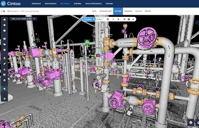
Cintoo's AI-powered classification recognizes and categorizes objects in 3D scan data. AI ingestion structures raw information into actionable insights, accelerating workflows while reducing manual processing effort.
Machine learning models learn patterns from training data. These models can flag unusual conditions, potential errors, or areas requiring human review. Automated quality checks supplement rather than replace expert verification.
In Conclusion: Building Your As-Built BIM Documentation Strategy
As-built BIM documentation delivers measurable value for enterprise AEC and industrial teams. Accurate site data improves QA/QC effectiveness, reduces rework costs, and supports better decision-making throughout project lifecycles.
Success requires combining appropriate technology with clear processes and trained personnel. Start with specific high-value use cases rather than attempting enterprise-wide deployment immediately. Document lessons learned and expand based on demonstrated results.
Cloud-based platforms that convert complex scan data into accessible, shareable formats enable collaboration across distributed teams. Hardware-agnostic approaches protect against vendor lock-in while supporting optimal equipment selection for each application.
The teams achieving greatest value treat as-built documentation as a strategic capability rather than a project-by-project expense. Accumulated data assets and institutional knowledge compound over time, creating competitive advantages that grow with each completed project.
Ready for your laser scan data to become a centralized source of truth that your whole team can access? Give the Cintoo platform a try.



.png?width=48&height=48&name=sensors%20(1).png)
.png?width=65&height=50&name=sensors%20(2).png)


.png?width=69&height=50&name=cloud_done%20(1).png)


.png?width=42&height=49&name=Group%2015496%20(2).png)


.png?width=60&height=60&name=calendar%20(1).png)


.png?width=48&height=45&name=image%20175%20(1).png)