Digital twins from laser scans are rapidly transforming how organizations understand, manage, and optimize physical environments. From construction and engineering to manufacturing and facilities management, laser‑scanned digital twins provide a living, data‑rich replica of the real world.
Unlike introductory digital twin overviews, this article focuses specifically on how laser scanning technology powers highly accurate, reality-based digital twins and why scan-derived data is becoming foundational for AI, analytics, and operational intelligence.
As industries move toward automation, predictive analytics, and AI‑driven decision‑making, the demand for highly accurate spatial data has never been higher. Laser scanning technology, combined with advanced modeling software, makes it possible to create digital twins that are not only visually precise but also analytically powerful.
According to McKinsey, digital twins can reduce maintenance costs by up to 25% and decrease downtime by as much as 50% in industrial environments when paired with predictive analytics and operational monitoring.
In this article, we’ll explore what digital twins from laser scans are, how they’re created, why they matter, and how organizations can leverage them for long‑term value.
A digital twin is a virtual representation of a physical asset, environment, or system that mirrors its real‑world counterpart. When digital twins are created from laser scans, they are built using highly accurate 3D data captured through technologies such as LiDAR or terrestrial laser scanning.
Laser scanners emit millions of laser pulses per second, measuring the time it takes for each pulse to bounce back. The result is a point cloud—a dense collection of spatial data points that precisely map surfaces, geometry, and spatial relationships, providing the digital twin version.
This point cloud becomes the foundation for:
The result is a digital twin that reflects reality as it truly exists.

Not all digital twins can be the same accuracy-wise. In fact, many variations of a digital twin can exist. However, digital twins from laser scans stand out because of their unmatched accuracy, completeness, and reliability and this will make the AI and analytics dependencies that much more efficient to work off of.
Key advantages include:
For organizations managing high‑value assets or safety‑critical environments, these benefits make laser‑derived digital twins the superior form.
Industry analysts increasingly recognize reality capture as a critical foundation for operational digital twins. Gartner notes that organizations using accurate digital twin environments improve asset visibility, collaboration, and maintenance planning significantly faster than teams relying on static documentation alone.
Creating a digital twin from laser scans typically follows a structured workflow:
Terrestrial, mobile, or aerial laser scanners capture millions to billions of data points.
2.Point cloud processingRaw scan data is registered, cleaned, and aligned to create a unified coordinate system.
3. Model development
The point cloud is converted into usable formats such as 3D meshes, CAD models, or BIM models. In Cintoo, the point cloud is converted to a high-fidelity 3D mesh, making the cloud-based data easy to navigate and accurate.
4. Data enrichment
Metadata, asset information, sensor data, or operational parameters are added to the model. Cintoo also allows for this bidirectional data flow based off the 3D scan data.
5. Integration with platforms
The digital twin is connected to analytics tools, facility management systems, or simulation software.
This process transforms static geometry into a dynamic, intelligence‑ready digital asset.

Construction and Engineering
Digital twins from laser scans help teams validate as‑built conditions, reduce rework, and improve coordination between trades. They also support clash detection and construction progress tracking.
Facilities Management
Facility managers use laser‑based digital twins to manage space utilization, plan maintenance, and visualize building systems without invasive inspections.
Manufacturing and Industrial Sites
In complex plants, digital twins enable layout optimization, safety planning, equipment retrofits, and downtime reduction without interrupting operations.
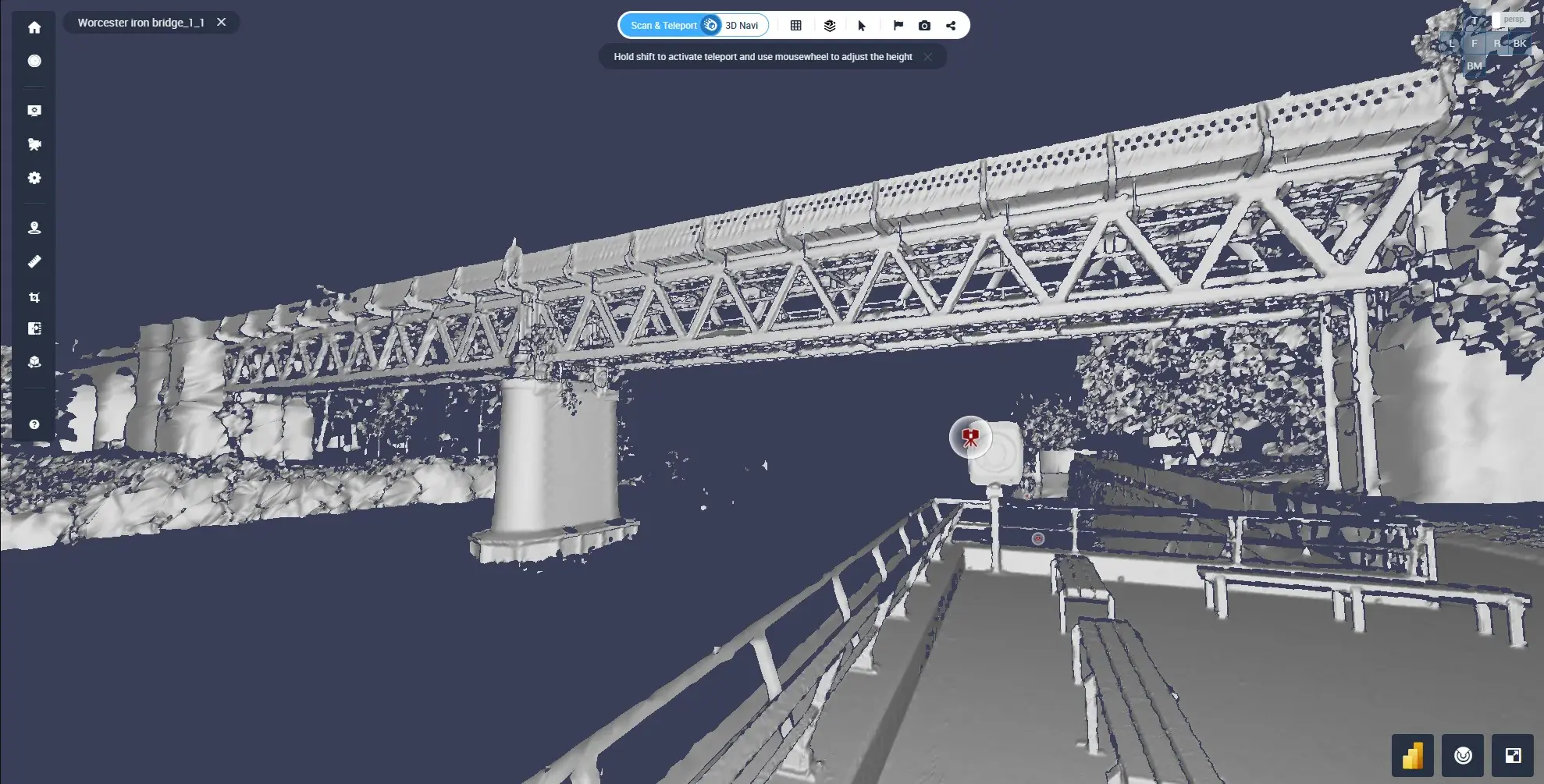
Infrastructure and Transportation
Bridges, tunnels, rail systems, and airports benefit from scan‑based digital twins that support inspection, lifecycle analysis, and future upgrades.
Smart Cities and Urban Planning
City planners use digital twins to analyze traffic flow, environmental impact, and infrastructure resilience using accurate 3D city models.
Large industrial operators are increasingly using laser-scanned digital twins to modernize aging facilities without disrupting operations.
For example, global energy companies such as BP have invested heavily in digital twin initiatives to improve operational visibility, asset management, and predictive maintenance across complex infrastructure environments. By combining laser scan data with operational systems, teams can remotely inspect facilities, simulate modifications, and reduce the need for repeated field visits.
In manufacturing, companies using scan-based digital twins have reported measurable improvements in maintenance planning, reduced rework during retrofits, and faster coordination between engineering teams and contractors.
The key advantage is accuracy: when teams work from current, reality-captured conditions instead of outdated drawings, decision-making becomes significantly faster and more reliable.
AI systems rely on high‑quality data. Digital twins from laser scans provide structured, spatially accurate datasets that AI models can trust.
When paired with AI, scan‑based digital twins enable:
Because laser scans capture objective reality, they reduce bias and uncertainty in AI‑driven insights. This makes them especially valuable for mission‑critical decision‑making.
According to Deloitte, organizations implementing AI-enabled digital twins are seeing improvements in operational efficiency, asset utilization, and maintenance forecasting—especially in manufacturing, energy, and infrastructure sectors.
What is the difference between a laser scan and a digital twin?
A laser scan captures raw spatial data in the form of a point cloud. A digital twin uses that scan data as the foundation for a dynamic, interactive digital representation enriched with asset information, analytics, and operational context.
How accurate are laser-scan digital twins?
Modern terrestrial laser scanners can achieve millimeter-level accuracy, making them ideal for industrial facilities, construction verification, infrastructure inspections, and retrofit planning.
How much does a laser scan digital twin cost?
Costs vary depending on site size, complexity, required accuracy, and deliverables. Small building scans may cost a few thousand dollars, while large industrial facilities or campuses can require significantly larger investments. The long-term value often comes from reduced rework, improved maintenance planning, and operational efficiency.
What industries benefit most from scan-based digital twins?
Construction, manufacturing, energy, infrastructure, architecture, facilities management, transportation, and smart city planning all benefit from accurate reality-capture workflows.
One of the most overlooked benefits of digital twins from laser scans is future readiness. Once the real world is captured in high resolution, organizations can adapt the same data for emerging technologies such as:
In other words, laser‑based digital twins can enhance an organization’s digitization and analytics-driven strategy beyond the first iteration of the data.