Emesent partners with Cintoo to deliver versatile end-to-end reality capture solution
Hovermap LiDAR point clouds and panoramic images can be easily viewed and shared in high quality across multiple locations through Cintoo’s platform, enhancing communication and interpretation of 3D scan data.
Emesent, maker of the award-winning Hovermap LiDAR mapping and autonomy solution, has partnered with Cintoo, the leading cloud platform provider for collecting, collaborating, sharing, and managing reality capture data, to deliver high resolution web-based visualization of 3D scan data for the Architectural, Engineering and Construction (AEC) industry.
Hovermap is a SLAM-based mobile LiDAR scanning system which offers a versatile range of point cloud data capture methods through autonomous robots, vehicle mounts and handheld scanning. It can also capture panoramic images which are georeferenced to the point cloud and provide additional reality capture context.
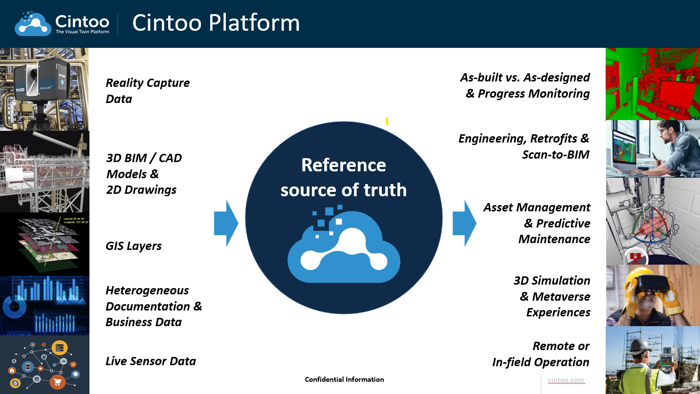
Cintoo’s platform converts point cloud data into a 3D mesh, simplifying the viewing and interpretation process without any loss of resolution. The Cintoo platform is designed to bring reality-capture data into scan-to-BIM workflows, optimizing the comparison to BIM and CAD models as well as Digital Twin technology and asset tagging.
“Hovermap is renowned for delivering fast, accurate, survey-grade 3D data, but for applications such as asset or site inspection, the captured LiDAR data is often required to be viewed remotely across multiple sites,” said Emesent co-founder and Chief Strategy Officer, Dr Stefan Hrabar. “Cintoo enables us to deliver this in ways we haven’t previously offered on our own. Our aim is to make the relevant workflows from capture to analysis as streamlined as possible. To achieve that, we looked for a cloud-based visualization platform that could handle the rich 3D data and images produced by Hovermap. Cintoo helps us support this goal,” Dr Hrabar said.
Cintoo co-founder and CEO Dominique Pouliquen said the end-to-end 3D scan data solution partnership with Emesent will provide significant customer value. Cintoo and Emesent will offer a versatile new 3D scan data solution that promotes Hovermap data streamed in the Cintoo platform.
Customers will be able to use Cintoo to merge data from various scan sources (mobile, terrestrial, drone) regardless of the hardware vendor, including Emesent’s Hovermap technology. Importing BIM/CAD models and overlaying them to the scan data will allow customers to run comparisons and identify and resolve issues quickly. Further, Cintoo can be intergrated into asset management, IoT and Digital Twin ecosystems to display and document tagged equipment in their as-built conditions, thus providing accurate context. Cintoo will be a centralized repository for 3D scan data produced by Emesent Hovermap, making visualization and scan-to-BIM processes more efficient and accurate. “We’re excited to be partnering with Emesent, allowing us to jointly offer a complementary solution for the capture, processing and sharing of high-definition Digital Twin data to AEC customers,” said Dominique Pouliquen, CEO of Cintoo.
Looking ahead, Emesent and Cintoo are excited to deliver a more versatile solution for the automotive and manufacturing industry. Hovermap can deliver robust reality capture data important in the monitoring and maintenance of industrial assets within a manufacturing factory. Point cloud data will become democratized in the Cintoo platform, meaning any vendor within a manufacturing workflow or process will have virtual access to the plant site.
About Emesent:
Emesent is a global leader in autonomous mapping technology, providing an innovative 3D data capture, processing and visualization solution for industries such as mining, public safety, oil and gas, construction, and engineering. Their flag-ship product Hovermap enables organizations to capture 3D LiDAR data quickly, efficiently, and safely in challenging and time-sensitive environments. Emesent’s products are used by clients worldwide to enhance productivity and decision-making. Established in 2018, Emesent was founded by Dr Stefan Hrabar and Dr Farid Kendoul, following a decade of robotics research at Australia’s CSIRO.
About Cintoo:
Cintoo offers companies working in Digital Twin, AEC and Industry 4.0 a cloud-based SaaS solution to manage 3D scan data collected from real-world built spaces. The Cintoo solution is agnostic to any scanning hardware, including drone, mobile or terrestrial scanners. Cintoo offers a centralized repository for all visualized data with no compromise to accuracy. Point cloud data is converted to 3D meshes in the Cintoo platform, enhancing QA/QC workflows, asset tagging and comparisons to BIM/CAD models. Cintoo is being used by more than 450 companies in 43 countries worldwide for all experts and non-experts alike.
For more information about how Hovermap point clouds can be viewed in Cintoo, contact Emesent.
Client case studies are available on the Emesent website.
Start a free demo of the Cintoo platform or follow Cintoo on LinkedIn.