Think You Know How to Optimize Your Site Maps?
Little is known about the new map mode offerings that can level up your site maps and project views. In this blog, we’ll discuss the differences between Google Earth and ArcGIS by Esri and how you can make the most of intuitive platforms like Cintoo that combine map modes that yield more insights.
Site maps, site maps, and more site maps.
In the world of 3D digitization, it’s essential to have a handle on how your project site map is viewed, the map modes that can offer new ways forward for visualizing your space, and how a basic site map gets integrated with many other surface area views.
On a construction project or site facility renovation, sometimes the areas can be millions of square feet in size, raising more questions than answers when configuring as-built conditions to understand the digital context.
Google Earth or ArcGIS?
In today’s world, Google Maps navigation ain’t gonna cut it. Google Maps (Google Earth) is not only cumbersome and rigid in what they offer for map modes, but it’s also just not built for businesses.
ArcGIS, offered by Esri, is used in business to help predict the future, powered by analytics that offer geospatial data upfront. Google Earth, powered by Google Maps, is primarily used for navigation.

What combines both approaches, the element of intuitive navigation as well as map modes that help predict the future in your site, is Cintoo, now a proud partner of Esri.
How Do Esri Maps Work For Your Cintoo Project?
Cintoo has totally transformed their interface to offer a new way to access and work through your site and facility maps. “The Esri base layers can be accessible through my project view, so when a user logs into Cintoo, the geographical information is powered by Esri,” says Victor Ruiz Conde, Product Manager at Cintoo.
How does this all work and what does this look like, you ask?
Well, let’ talk about use cases to show how geospatial data offers new ways forward for visualization and digitization.
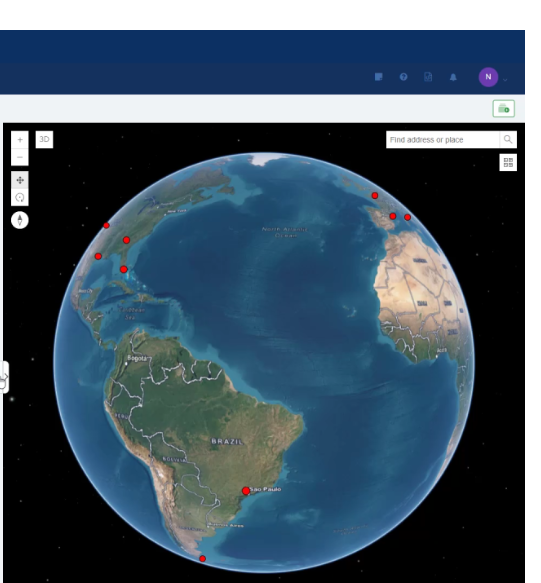
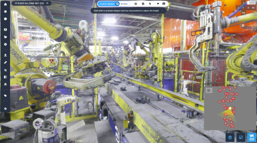
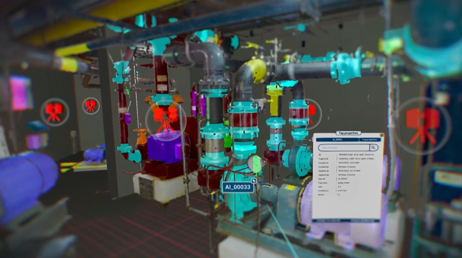
Right off the bat, when you log into Cintoo, ‘My Projects’ is powered by Esri Maps. That means map modes are already synced to your valuable geospatial (laser scan point cloud) data. “3D view users can now incorporate Esri layers with BIM data,” Victor explains. “So essentially you’re building and running information more seamlessly.”

Esri public base maps offer 2D and 3D imagery to fit your needs. 3D base maps are particularly important for their ability to offer a full 3D context to a project site. This ensures accuracy when working through the program to deliver all views available. Actually, there are SO MANY choices in Esri’s public base map offerings, allowing users the ability to choose the view that best aligns with their purpose (like Open Street Map, Chartered Territory Map, Human Geography Map, Topographic Map, and more).
Locations can be filtered by address, postal code, or latitude and longitude. The program is intuitive enough to drill down into a specific site based on the data. Share project data instantly to other vendors and colleagues, meaning better collaboration based on more specific site maps views.
Make The Right Choice to Optimize Your Site Map Data
Nothing comes close to what ArcGIS by Esri offers, especially in its ability to instantly share data to another source—could be any site or map view that you choose.
That’s why it’s important to have a handle on the options available for making the most out of your geospatial data. Once you can get the right and most precise project views, paired with the ability to share it across domains, new builds and renovations become easier to define and manage.
Esri is innovating across their ArcGIS offerings, with new ways to visualize important site map data to be shared through intuitive, web-based platforms like Cintoo. Make the most of your site maps today!

