Unlock the full potential of your indoor mobile and terrestrial scans
In today’s evolving and fast-paced construction industries, where precision and efficiency are paramount, terrestrial laser scanning has emerged as a cornerstone technology. Whether for construction, manufacturing, or infrastructure management, the need for high-quality scan data is universal. But are you truly maximizing the potential of your 3D scan data? In this blog, learn how you can elevate your scanning workflows, achieving data centralization, enhanced collaboration, and impressive cost savings.
What is Terrestrial Laser Scanning?
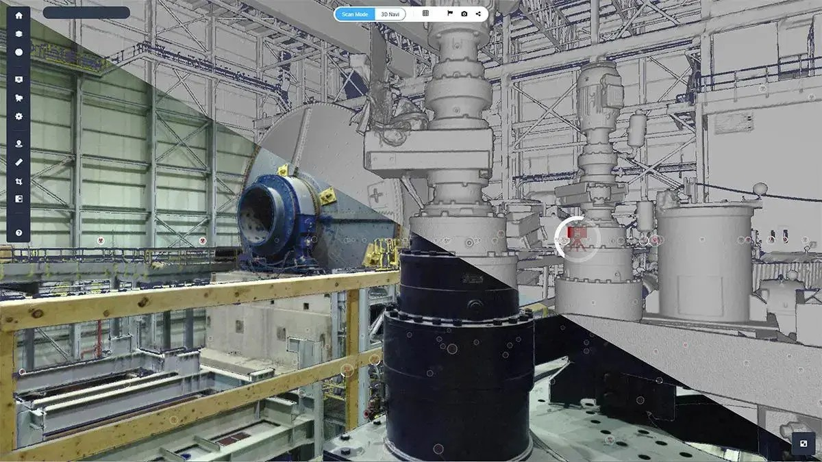
Terrestrial laser scanning (TLS) is a method of capturing highly detailed 3D spatial data by emitting laser pulses from a stationary device. Widely used for mapping, modeling, and monitoring large-scale projects, terrestrial laser scanning is a game-changer in fields like construction, manufacturing, and public infrastructure.
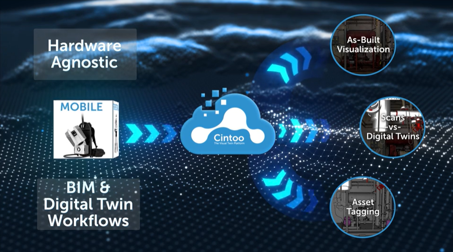
Paired with indoor mobile scanning, it allows for seamless data acquisition across diverse environments, transforming raw data into actionable insights. It is easier than ever before to use a combination of terrestrial scanners, including indoor mobile scanners or static scanners, to generate point clouds of a whole site– meaning a virtual representation is seamlessly facilitated. But there’s a quick catch here: to really delve into the point cloud data obtained from a mix of LIDAR/terrestrial scanning, the data then needs to be transferred to a platform that can render, store and visualize the point cloud data with no compromise to storage requirements or accuracy. Unlock the full potential of point cloud data by using a robust, cloud-based platform like Cintoo to upload, manage, and navigate.
Cintoo: Centralized Data for Streamlined Workflows
One of the most significant challenges in leveraging terrestrial laser scanning data is managing its sheer volume. Large-scale projects often face data fragmentation, making it difficult for teams to access and collaborate on point cloud models effectively.
Cintoo solves this by centralizing all your laser scan data in a secure, scalable cloud environment. Key benefits include:
- Reliable Access: Teams can easily upload, manage, and share their terrestrial laser scanning and indoor mobile scan data from anywhere.
- Enhanced Collaboration: Real-time model sharing fosters better communication, ensuring that all stakeholders work from the same reality capture data, no matter where they are.
- Accelerated Timelines: Streamlined data management reduces silos, helping you complete projects on time and within budget.
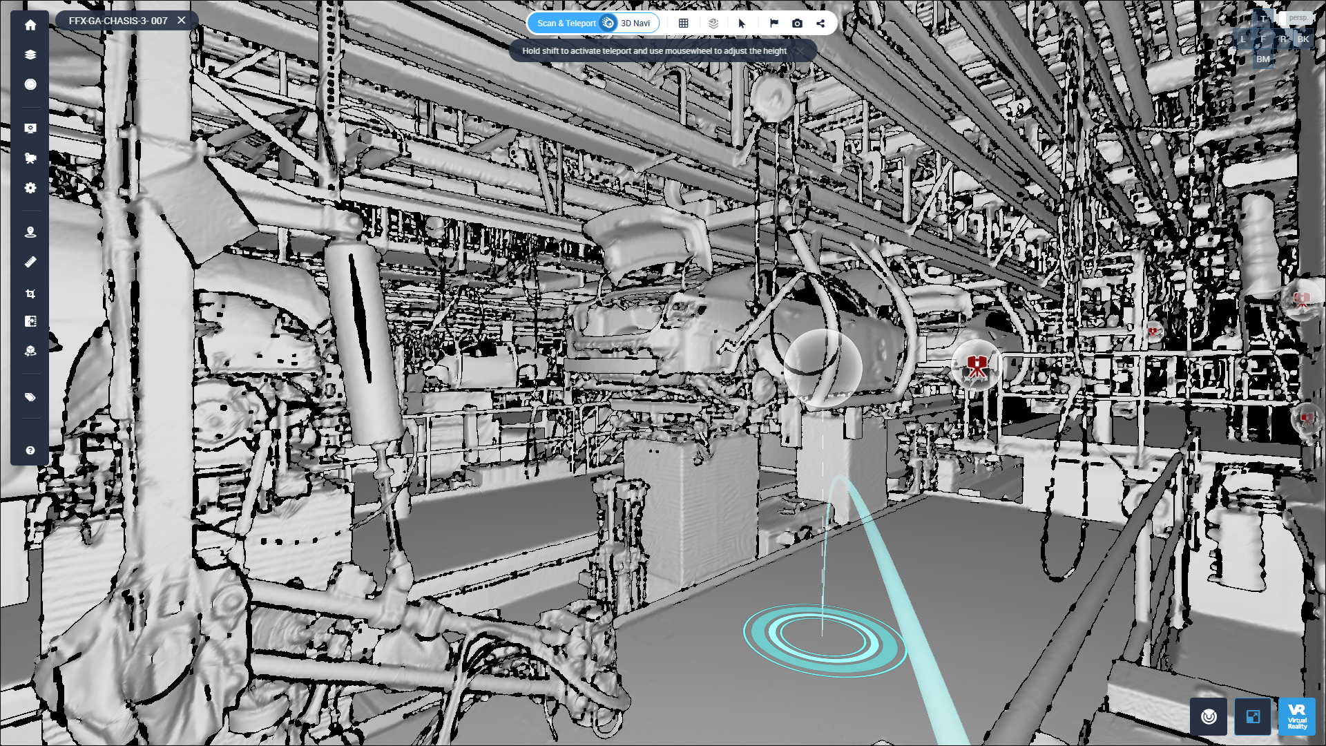
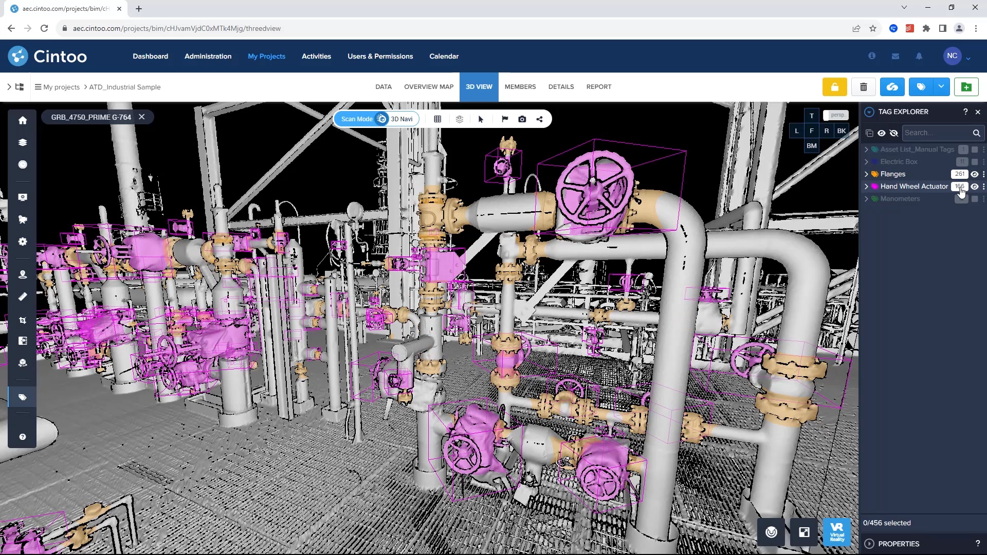
The key to harnessing the power of 3D scan data acquired from terrestrial laser scanning is in having a robust repository that allows seamless collaboration. This means that in your 3D scan data workflow you should use a platform that gives you enhanced tools, allowing you to make measurements, take annotations, overlay models, navigate without interruption, and monitor progress.
Maximize ROI with Cost Savings
Using Cintoo isn’t just about investing in a platform that helps you better manage your laser scan data– it’s about helping you get the most ROI from your projects. Here’s how Cintoo helps optimize your investment in terrestrial laser scanning:
- Reduced Site Visits: Minimize costly in-person inspections by enabling virtual site visits through centralized scan data.
- Improved Decision-Making: Quick access to accurate 3D scan data ensures timely and informed decisions.
- Operational Efficiency: By integrating 3D scan data seamlessly into your workflows, you eliminate redundancies and reduce delays. Collaborate across the platform with an unlimited number of users, meaning you can share project views and information to anyone who needs it.
Real-World Applications of Terrestrial Laser Scanning with Cintoo
Construction and Infrastructure
From planning to execution, terrestrial laser scanning is indispensable for construction projects. Once point cloud data is uploaded into Cintoo, a host of capabilities can aid in clash detection, site inspections, and construction progress monitoring, enabling teams to stay on top of every detail. Consider how Studio Steel, a metal fabrication business specializing in structural steel and customized metal works, uses Cintoo to detect clashes. As Clint Stevens, BIM Coordinator at Studio Steel, says, “Cintoo has helped us detect problems before they occur and by creating visual reports, we can communicate to others with clarity and all the context needed to make decisions.”

Manufacturing and Utilities
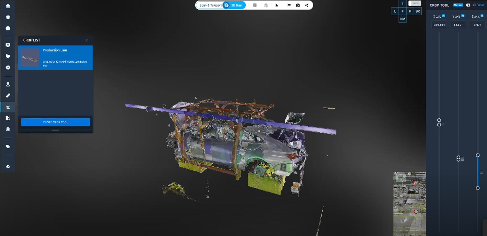
Efficiently manage facilities, perform remote inspections, and ensure continuity of operations with centralized 3D scan data accessible in Cintoo. Ensure that every stakeholder is on the same page in the development of specific project aspects, or align with engineers on retrofitting or updating huge facility floor spaces. Take how GM, one of the largest car manufacturers in the world, uses Cintoo to install equipment successfully on the plant floor, all within the first go. “The visual scope in Cintoo has immense value. What our team has done is reduce the number of surprises and surprises cost money.” John Brown, Supervisor of Reality Capture says. Certain capabilities in the Cintoo platform, paired with the scan-to-mesh conversion of point cloud data, helps John’s team identify, tag, and push issues which further eliminate costly surprises.
Public Works and Government
Government agencies rely on Cintoo for securely managing public infrastructure projects, providing accurate data to support maintenance and future developments. With the latest ISO-270001 verification, Cintoo is a reliable security partner that can keep your point cloud data and project insights in one secure platform.
Embrace Digital Transformation with Cintoo
The transition to cloud-based solutions like Cintoo is more than a technological upgrade—it’s a strategic leap toward digital transformation. By supporting scalability, enhancing data accessibility, and promoting innovation, Cintoo aligns with your broader digital goals.
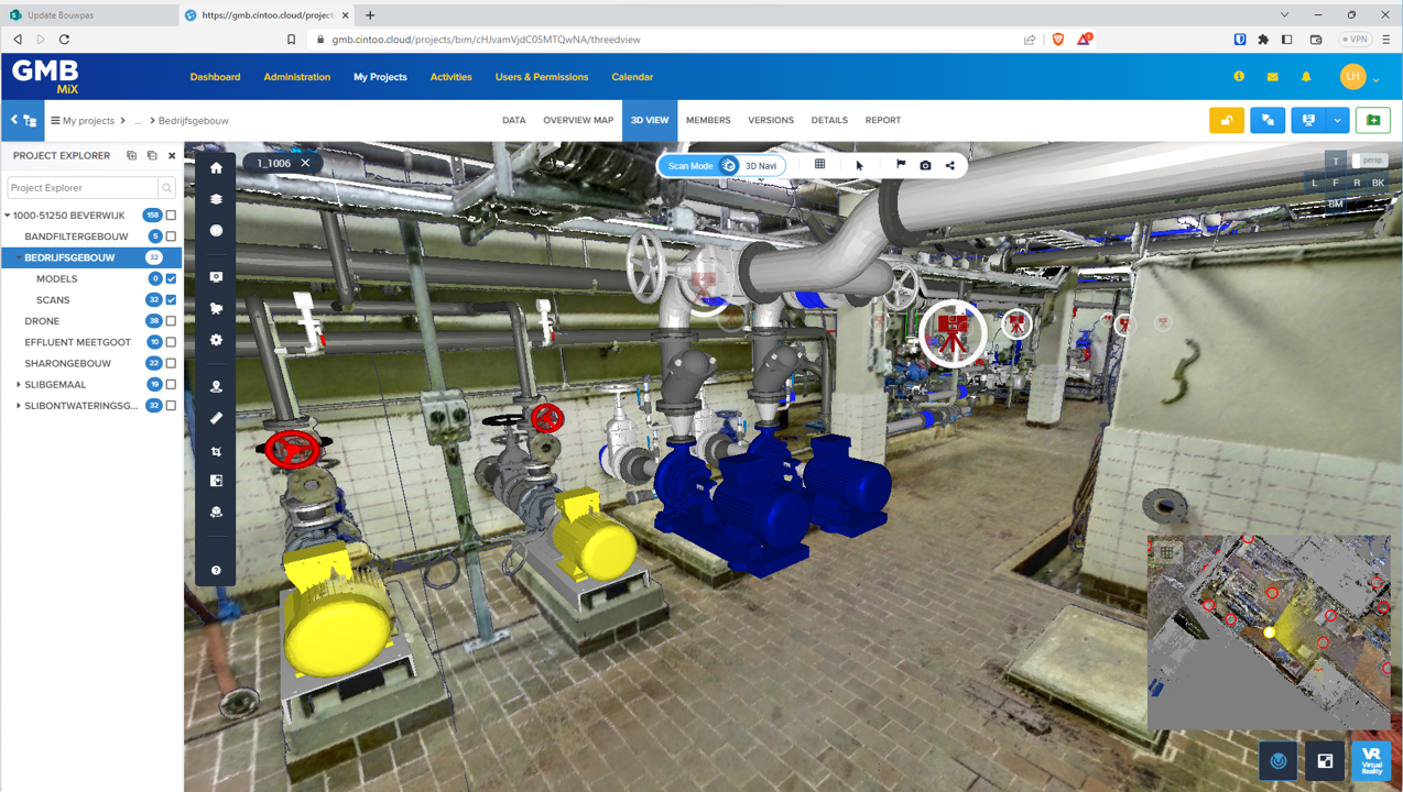
Ready to Unlock the Power of Terrestrial Laser Scanning?
With Cintoo, your terrestrial laser scanning data becomes more than just information—it becomes a competitive advantage. Ready to explore how Cintoo can revolutionize your workflows? Download this ebook to learn how you can extract all the details from your3D laser scanning data!
