MIAMI, FL – October 7, 2025: Cintoo has announced the release of its new widget for ArcGIS, enabling users to stream and interact with high-resolution, mesh-based laser scan data directly within the Esri environment.
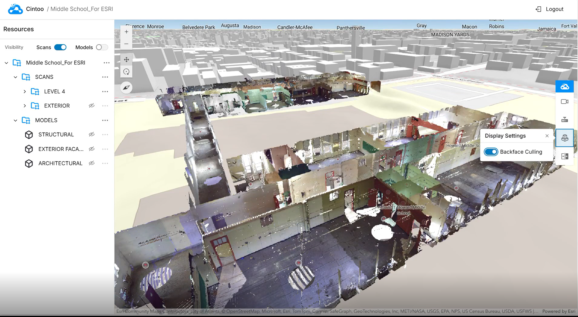
The integration allows terrestrial and mobile LiDAR data to be converted into lightweight 3D meshes, maintaining full point cloud fidelity while enabling teams to effortlessly work with what were previously large, complex datasets.
The Cintoo Widget brings immersive 360-degree panoramic views and virtual inspection capabilities to ArcGIS, particularly beneficial for indoor and brownfield projects where conventional GIS tools often struggle to handle dense or detailed spatial data.
Users can analyse scan data, compare it to BIM and CAD models, and manage asset tags without leaving the ArcGIS environment. Whether managing a large-scale facility, modernising a manufacturing line, or overseeing construction progress, geospatial analysis is amplified with real-time site conditions.
“ArcGIS is used by 70% of the largest companies globally so this is a really exciting opportunity for us to demonstrate to the Esri ecosystem how our platform brings much-needed visualisation and insight and why many Cintoo customers in Building Construction & Operations, Automobile Manufacturing and Energy, such as BP and TotalEnergies, have already integrated it into their daily workflows,” said Dominique Pouliquen, CEO of Cintoo.
“Increasingly, integrating LiDAR and other types of imagery into GIS is becoming an indispensable part of modern project workflows and we are happy to make this possible for Cintoo’s customers,” said Kathleen Kewley, Esri director of AEC global business development. “In fields like construction and facilities management, modern 3D GIS is critical for dynamic awareness of assets and processes.”
Further integration between the two companies is on the horizon. Future developments will further expand Cintoo’s 3D mesh technology across the ArcGIS platform, making high-resolution, streaming mesh layers accessible to GIS users across the globe.
About Esri
Esri is the global market leader in geographic information system (GIS) software, location intelligence, and mapping, helps customers unlock the full potential of data to improve operational and business results. Founded in 1969 in Redlands, California, USA, Esri software is deployed in hundreds of thousands of organisations globally, including Fortune 500 companies, government agencies, nonprofit institutions, and universities. Esri has regional offices, international distributors, and partners providing local support in over 100 countries on six continents. With its pioneering commitment to geospatial technology and analytics, Esri engineers the most innovative solutions that leverage a geographic approach to solving some of the world’s most complex problems by placing them in the crucial context of location. Visit us at esri.com.
About Cintoo
Cintoo specialises in innovative cloud-based solutions for the management, visualisation, and analysis of reality capture data. The Cintoo platform enables AEC and Industry 4.0 organisations to upload 3D scan data from terrestrial scanners, mobiles and drones and use it to drive efficiencies and enhance decision-making. Sync scans and models by integrating with BIM coordination platforms, like Autodesk Construction Cloud, GIS platforms like Esri ArcGIS, or connect to Digital Twin, document management or IoT platforms with asset tagging. For more information, visit www.cintoo.com or www.linkedin.com/company/cintoo.
Media enquiries:
Juliet Fisher : juliet@merchant.agency / +44 (0)2380 225478