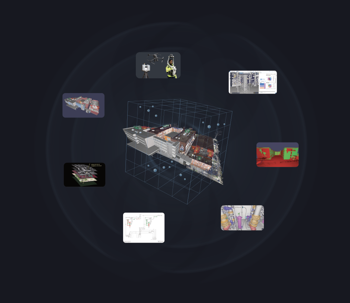
Every site visit has a price: flights, hotels, days away from the desk, and time spent in areas where nobody wants to linger. For energy, manufacturing and construction teams running sites across several regions, those trips stack up fast.
A virtual site inspection lets your team check conditions, take measurements and compare what’s built against the design from a web browser, using laser scan and 360° data already captured on site. This guide walks through the workflow, what it saves, and how BP verified a drain header remotely for more than $15,000 less than a site trip.
How much can a virtual site inspection save?
It depends on how often and how far your teams travel. In one documented case, BP used scans in Cintoo to verify a drain header slope remotely, avoiding more than $15,000 in equipment rental, labor and handling costs with no downtime. Axalta cut site visits per project from four or five to one or two.
What is a virtual site inspection?
A virtual site inspection is a remote check of a site’s real conditions using captured 3D data, such as laser scans and 360° imagery, instead of a person on site. Inspectors measure, compare against BIM or CAD models and log issues from their desk. Unlike a live video call, the data stays available for the next inspection, and the one after that.
A video call shows what someone on site points their phone at. A scan-based inspection lets you go anywhere the scanner went, take your own measurements, and come back later without asking anyone to walk the site again.
Why Reducing Site Visits Matters
Site visits are expensive, and the cost isn’t just the ticket. Every trip involves travel costs, lost productivity, and the potential for project delays. In hazardous industries like energy, they also add risk to personnel safety. For global companies with distributed assets, the problem scales quickly.
- High costs: flights, hotels, vehicle rentals and support staff, repeated for every check.
- Lost productivity: engineers and technicians spend hours or even days traveling instead of solving problems.
- Safety risks: every trip to a live plant or active job site is more time spent near hazards.
- Environmental impact: frequent travel leaves a large carbon footprint, running counter to corporate sustainability goals.
Reality capture changes the math. Scan a facility once with LiDAR, and your team gets a measurable, full-resolution record of it that anyone can explore remotely. This allows for virtual site inspections and decision-making without requiring physical presence.
How a virtual site inspection works: a 5-step workflow
1. Capture. Scan the site with terrestrial, mobile or drone scanners. Between full scan campaigns, field teams can add quick 360° captures with a Ricoh THETA camera through 360 Edition to keep conditions current. Planning the capture well pays off later: this ebook covers the process from start to finish.
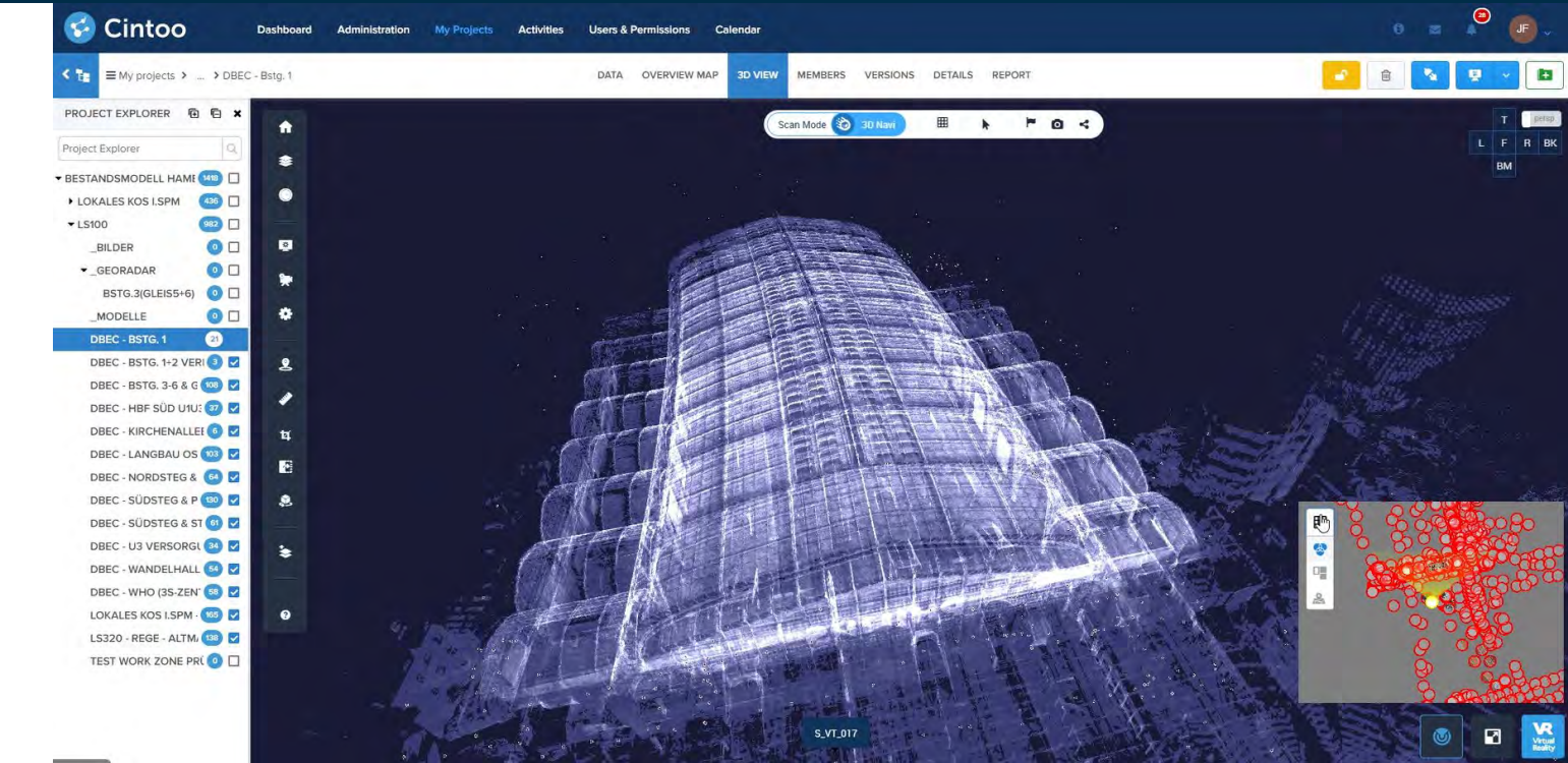
2. Register and upload. Register the scans in your usual software, then upload them to Cintoo. Cintoo converts heavy point clouds into lightweight, high-resolution meshes that stream in any web browser, without losing accuracy.
3. Inspect. Walk the site virtually. Measure distances, slopes and clearances. Overlay BIM or CAD models to check as-built conditions against the design, and compare 360 captures with scans and models side by side.
4. Flag and assign. Pin annotations to the exact spot in 3D, attach photos, documents or links, and assign follow-up to the right person.
5. Report and share. Export a PDF report and share it with stakeholders, who only need a browser to open the project.
When should you still go on site? For hands-on work, physical testing, or areas that were never captured. The goal isn’t zero site visits. It’s making sure every trip you do take is one that’s actually needed.
A Real-World Example: BP Verifies a Drain Header Remotely
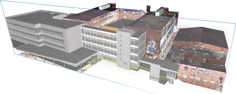
BP, one of the world’s largest energy companies, operates thousands of miles of pipelines and facilities worldwide. Traditionally, verifying a detail like the slope of a drain header would have required sending an engineer to site—a costly and time-consuming trip.
Instead, BP used Cintoo to access recent facility scans with the scans already in Cintoo, the team had an accurate, current view of the site. An engineer located the relevant point cloud, switched to 3D view, and used Cintoo’s measurement tools to verify the slope of the drain header. The measurement was then exported to a PDF report and shared with stakeholders, all without setting foot onsite.
The result?
- $15,000+ saved in equipment rental, labor, and handling costs,
- No downtime or schedule delays.
- Reduced travel emissions, supporting BP’s net-zero goals.
- Improved safety, with personnel avoiding unnecessary site exposure.
One measurement, one report, no trip. The same scans now support BP’s remote monitoring and maintenance work as well. It allows users to use virtual walkthroughs for more robust purposes, including remote monitoring and maintenance as well.
Watch the full webinar with BP on how they manage facility and pipeline maintenance virtually.
Remote Site Inspection by Industry
The workflow is the same everywhere. What changes is the question you’re answering remotely.
1. Energy
Oil and gas companies, utilities, and power generation facilities often span huge geographies. Reality capture lets central teams inspect assets, track corrosion and review maintenance needs without sending crews into the field, track corrosion, and review maintenance needs remotely. For pipelines, offshore platforms, or substations, this reduces the logistical burden of sending specialized teams into the field.
2. Utilities
Water and wastewater networks spread treatment plants and pumping stations across wide areas, often in tight, hard-to-reach spaces. A current scan of each facility lets engineers plan maintenance and upgrades before a crew ever leaves the depot.
2. Manufacturing
Manufacturers managing large production plants can use laser scanning to document as-built conditions and plan retrofits or expansions without disrupting operations. Remote teams can validate layouts, verify clearances for equipment installation, and collaborate with vendors globally. This reduces costly downtime while ensuring modifications are accurate the first time.
Coatings manufacturer Axalta went from four or five site visits per project to one or two. “We’re very satisfied with Cintoo, especially with the fact that site visits have been significantly reduced, leading to significant time and cost savings within our projects,” says Marco Schuh, CAD / BIM Administrator Engineering at Axalta.
3. AEC (Architecture, Engineering, and Construction)
In construction, site visits are traditionally frequent—from pre-design surveys to constant inspections. By using scan-first digital twins, architects, engineers, and contractors can conduct design reviews, clash detection, and progress tracking virtually. This minimizes travel while improving accuracy and avoiding costly change orders.
At Arup, teams look around their builds, take measurements and understand what’s there without going out to site. Architecture firm Stevens & Wilkinson used to send teams to measure every new project by hand. Now they review existing HVAC, plumbing, conduit and drainage in Cintoo first. “With Cintoo, we can solve problems very quickly by having the accurate dimensions from the start,” says Bill Polk, Principal Architect.
Fewer Trips, Lower Emissions: The ESG Case
Business travel counts toward a company’s reported emissions. That makes every avoided trip a measurable line in your ESG reporting, not just a nice side effect.
BP’s remote drain header check is a good example. The trip that didn’t happen saved money, kept people out of the facility, and supported the company’s net-zero goals at the same time. Multiply that across a portfolio of sites and recurring inspections, and travel reduction becomes one of the simpler emissions levers an operations team controls.
Remote Collaboration in Cintoo
Once the scans are in Cintoo, your whole team works from the same reality. In Cintoo, teams can:
- Leave annotations on scans, assigning tasks or flagging issues.
- Attach files, links, or images to specific points in the 3D model.
- Export structured reports for project documentation.
- Integrate with tools like Autodesk Construction Cloud or Esri GIS for spatial context.
Engineers, project managers and external vendors all contribute from wherever they are, looking at the same data. No one argues over whose drawing is out of date.
How to Estimate the ROI of Virtual Site Inspection
Start with the trips you already make. For each recurring visit, add up:
- Travel and accommodation
- Engineer time spent traveling rather than working
- Equipment rental and on-site support
- Downtime or schedule delays caused by waiting for the visit
Then mark which visits were only about looking, measuring or confirming. Those are the ones a current scan can replace. BP’s drain header check fell squarely in that category. The checklist above walks you through it.
Start With Your Next Planned Trip
Look at the next site visit on your calendar and ask what it’s for. If the answer is “check a measurement” or “confirm what’s there,” a current scan in Cintoo can probably answer it from your desk, the way it did for BP.
See how it works on your own data.
FAQ about Virtual Site Inspection with Reality Capture
What’s the difference between a virtual site inspection and a video inspection?
A video inspection needs someone on site holding a camera, live, at a scheduled time. A scan-based virtual site inspection uses 3D data captured earlier, so you can measure, revisit and compare the site whenever you need to, without coordinating anyone in the field.
Are measurements taken remotely accurate?
Measurements in Cintoo are taken on full-resolution scan data, so their accuracy depends on the quality of the original capture and registration. That’s why planning the scan matters as much as the software you view it in.
How current is the data?
It’s as current as your last capture. Many teams scan on a fixed schedule and add 360° captures in between with 360 Edition to keep conditions up to date at a lower cost.
Do stakeholders need specialist software?
No. Cintoo streams scan data in a desktop or laptop web browser, so project managers, vendors and clients can review the site without installing point cloud software.
Can virtual site inspection replace all site visits?
No, and it shouldn’t try. Hands-on work and areas that were never scanned still need people on site. The aim is to cut the visits that only exist to look, measure or confirm.