Background
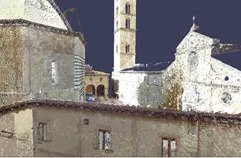
Since 2016, the Volterra-Detroit Foundation has worked in Volterra, Italy with experts in 3D reality capture technology, aerial and ground-based photogrammetry to record the city’s archaeological sites and artefacts. This collaborative group, known as the International Reality Capture Workshop is made up of architects, surveyors, 3D specialists, engineers, and historians from different organizations and countries.
The long-term objective is to create a complete digital document of Volterra’s sites using 3D tools and methodologies, to preserve these assets digitally and improve both archaeological and architectural research. As a work group, Volterra technology partners include Autodesk, Case Technologies, 3DR, Faro and Cintoo who can test their latest 3D products and solutions in a complex historical urban built environment.
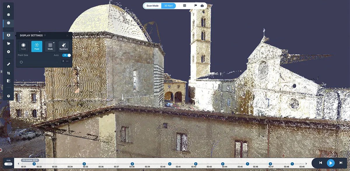
Cintoo approached Case Technologies, one of the key technology stakeholders in the project, to try a revolutionary new approach for handling the gigantic point clouds being generated from the terrestrial laser scans in Volterra: Cintoo Cloud.
Cintoo Cloud provides a unique point cloud-to-surface technology, to convert high-precision terrestrial laser scans into a 3D surface mesh before uploading to the cloud. The mesh reduces the file size of the point cloud data by between 10 and 40 times, without reducing data accuracy or simplification in any way. What’s also unique is that Cintoo Cloud can convert the mesh data back into its original format so it can be used directly in CAD software, with the same accuracy as the original point cloud source file.
Workflows Used
Cintoo Cloud
Autodesk Revit to construct BIM models
Autodesk ReCap Point clouds are also linked into Autodesk Revit software to be used to construct detailed Building Information Models (BIM). The Building
ReCap removes point overlaps and unwanted objects from scan All data is also being aggregated and integrated with GIS data in Autodesk Map3D and
Information Models may be used for accurate documentation to aid in research and also for asset and maintenance management applications.
Infraworks software to produce a produce a comprehensive, integrated digital resource for the city.